

It has been said that naming things demystifies difficult technologies, or removes the threat of illnesses, or provides characterization for the ineluctible. It also borders the amorphous, differentiates the integrated, and separates the contiguous. I agree with the latter assessment, since naming things also creates details I can't seem to remember.
Which brings you and me along the circuitous trail to the geology of the Grand Canyon. For my first few hikes, I could tell the rocks were different as I stumbled along, but I could make no sense of them, for to my eyes they changed too slowly. I could see red and yellow and cream and grey and green. I first learned that the distinctively sheer, smooth, vertical drops were redwall limestone, that I was crunching endlessly along the green Bright Angel shale on the wide Tonto Plateau, and that the dark, anonymous rock at the river gorge was ancient Vishnu schist. From my childhood "rockhound" days I knew a schist when I saw one, and I could also pick out a quartz here, a mica there, and could recognize lots of colorful sandstones and igneous, uh, stuff.
As time went by, the light-colored Kaibab limestone and Toroweap formation became obvious, though not particularly distinct; I figured out the Kaibab limestone only because that's where I started my hike down, and it's whitish. Coconino sandstone has that real, smooth-surfaced creamy-colored, well, sandstoney look. But I still call Tapeats sandstone "layer cake rock", and the rest of the formations make sense to me only from a distance--in other words, I have to look across the canyon from where I'm standing to know precisely what I'm standing on.
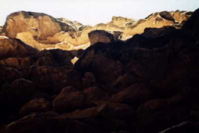
 My layer-cake shelves
I didn't want to become even so much as an amateur geologist or botanist to hike the Canyon (nor in fact even specifically a "Grand Canyon hiker"), so I needed to simplify my ability to recognize where I stood. I thought of patterns. Light to dark wasn't quite right, but open to closed fits pretty well. For myself, I ordered the Canyon colors in three groups, ever closing in a combination of brilliance and openness: on top are white, cream, tan, brown; then come red, grey, and green; finally come dusky brown, dark browns and greens, dark grey and black.
Now, if you don't mind, accompany me on a naming expedition from the rim to the river.
As you walk along the rim, you're already a mile below where towering mountains once stood, as great as and greater than the Rockies; and now you walk in one of many layers of seabed--you can frequently see fossils in this creamy white residue, today turned to hard and clanky Kaibab limestone. Descending through the first color group of white, cream and tan takes you from the rim's Kaibab limestone through the limestone-sandstone layerings of the Toroweap formation (hardly different to the amateur eye from the Kaibab) to the smooth Coconino sandstone, fine particles of quartz so smoothly arrayed that it falls evenly, leaving great blond cliffs.
Once your boots are crunching on light reddish-brown, you've come to Hermit shale and its variety of fossils of animals and plants--and raindrops themselves. This layer is followed by the Supai group of shales and other stone. Your Kaibab starting point is 250 million years old; the bottom of this Supai group adds 80 million years of prehistory to your footsteps. The newer sedimentary rocks and soils support richly aromatic trees and shrubs including junipers, pinyons, rabbitbrush and yucca; the Grandview Trail down to Horseshoe Mesa is particularly rewarding with its frequent shade and zephyr breezes of pungent air.
The towering Redwall--the first formation to distinguish itself with a name to most eyes--is really grey limestone stained a rich red, five hundred feet thick and eroding into sheer cliffs filled with marine fossils. It is joined at its base to grey Muav limestone, broken and chunky, and finally your hike lands at the bottom of the second color group: the greenish, wide, smooth terrain of Bright Angel shale, which began depositing as a muddy morass, and is now a fine-particled stone. Chances are you won't have noticed the redwall as you passed through it, because the trails are attention-grabbing and feet-punishing switchbacks like the Hermit Trail's famous Cathedral Stairs. But you will sigh with relief after you slam your last step through the scrabbly Muav limestone to the Tonto Plateau and its scrunchy cushion of green Bright Angel shale. You have walked, gently or not, through another 200 million years, and these old soils support blackbrush scrub, agave, yucca, and cacti (prickly pears, beavertails, barrels--all jolly and sharp).
The 90-mile-long Tonto Trail, winding on a surface of Bright Angel shale, is the great east-west highway of gently rolling plateau broken by washes and side canyons; it is exposed and hot, but comes with a fine view up the walls and occasionally down to the river. By the time you reach the Tonto, you will give up your tiredness for a while, for you are truly in the Canyon--and committed to it, because it will take as long to get back out as to achieve the river. As you descend the trail through a side canyon, you crack below the surface of the expansive Bright Angel shale to the third color group, beginning with the brown layer-cake rock of Tapeats sandstone, half a billion years old.
The virtually invisible miracle in your descent below the Tapeats will be the Great Unconformity, 250 million years of rock that has been eroded to virtual nothingness, so that in a footstep you slip back into time 825 million years past--part of your body in the paleozoic and the rest in the late precambrian era. Scrubbly creosote bush, agave, twisted mesquite, catclaw acacia and more varieties of cactus dominate the view. If luck is with you, the glimpse or sound of a Grand Canyon rattlesnake make come your way.
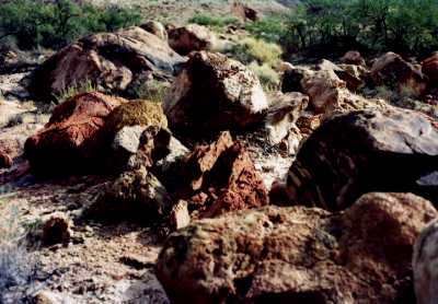
 Rock Garden at Espejo
Depending on your location along the meandering Colorado gorge, you'll be able to hike through various parts of the Grand Canyon supergroup, a tippy mix of dark browns, greys and greens: Cardenas lavas (drooling dark brown igneous rock that flowed a billion years past), the Dox sandstone (layer cake slipping sideways), glistening Shinumo quartzite, Hakatai shale (we often get stupidly stuck on shale cliffs trying to find our way up from the river), Bass limestone (grey shale over a billion years old) and finally--after dropping a few inches through the earlier, Precambrian Unconformity which erased 450 million years of geology--there appears the brooding, noble blackishness of Vishnu schist, the oldest exposed rock on earth ... predating fossil life, and 1.7 billion years ancient ... and up to a third of a mile thick.
And as you rest and recover on the sandy river beaches (or tributary streams, if you've gotten no farther) there will be the ever-present tamarisk (The Tammies), cottonwood, hackberry and various willows. Most grand of them all is the sacred datura--from the potato family, and offering a pungently moldy smell--with (if you're lucky enough to see them in bloom) huge, brilliantly white, trumpet-shaped flowers and cheerfully round, spiky, green seed pods. In your recovery you will begin to notice the fence lizards sunning and darting after insects, perhaps be in time for the great monarch butterfly migration, be serenaded by a too-cheerful canyon wren, sit in a warm pool of minnows nibbling your groin, watch the ravens watching you and your luscious packs, or just be entranced by the roaring rapids in this oldest touchable place on the planet.
By now, at last, you will likely not care whether you can distinguish Hakatai shale or Muav limestone, nor whether it was a prickly pear or cushion cactus you touched. The rising arc of the moon and the flaming canyon walls will silence your mind and the mirror of deep waters' transformation to powerful roil will quiet your questions. You will sleep hard in the miracle of this desert.
The Middle-Aged Hiker is Copyright ©1993-97,2002 by Dennis Báthory-Kitsz and David Gunn. All rights reserved.
![]() Please offer your comments.
Please offer your comments.
![]() Web pages by Malted/Media.
Web pages by Malted/Media.